Showing posts with label 歷史. Show all posts

2008-05-15

Taiwan's Southern Cape (恆春半島)

Shipwrecks and Headhunters


Taiwan's extreme southeastern coast, still one of the most remote and lightly populated corners of this island, served as backdrop for a series of shipwreck dramas during the mid-1800s that made far off Formosa the talk of the Great Powers and got pundits in the United States, Japan and elsewhere talking about either buying Taiwan from China's Manchu rulers or simply taking it by force.


Truculent weather, hidden coral reefs and hostile inhabitants irritated shippers and made Taiwan's dangerous shores an occasional cause célèbre for those out to make the world safe for civilization and Free Trade. In the two decades between 1850 and 1870 alone, some 150 Western vessels met their end in Taiwan waters.


In 1867, after crashing onto coral, crew and passengers of the U.S. ship Rover straggled onto a rocky stretch of southeastern shoreline only to lose their lives to indigenous Malayo-Polynesians (still headhunters at the time). A similar fate met the survivors of other shipwrecks, including 54 hands aboard a Ryukyuan fishing / trading boat that foundered along the same stretch of coast in 1871. Their capture and death at the hands of Paiwan (Botan, 排灣) warriors near the current town of Hsuhai (旭海村) gave Meiji Japan an excuse to dispatch an expeditionary force to the island in 1874, which lingered more than six months, killed several dozen of the elusive Paiwan and lost over 500 of their own number - mostly to tropical disease. This half year sojourn, known today as the "Mudan Incident" (牡丹社事件), is often cited (in hindsight) as the first move in a Japanese plot to wrest Taiwan from China - an effort that culminated two decades later in the 1895 Treaty of Shimonoseki (馬關條約).

I'd read about the wrecks and heard about the rough landscape that greeted survivors ... now I had a chance to see it firsthand. ... read on.

The Challenge

Cycling around Taiwan, either in sections or the entire 1,000+km circuit, has come into vogue over the past several years. The initiative has complex roots, but seems driven at its core by a growing desire among the population here to ponder their identity as Taiwan islanders (rather than immigrant or transplanted Mainland Chinese) and subsequent curiosity on the part of those with time (i.e., students) or money (mostly white collar professionals) to finally explore their homeland in a challenging but (now) socially acceptable way - straddling a top-of-the-line touring bike and wearing the latest in sweat-free fashion. The screening in 2006 of the semi-documentary film Island Etude (練習曲:單車環島日記) [link to YouTube trailer here, and great song from the film here] and promotional support from the island's globally competitive bicycle manufacturers gave the movement its 'wings' ... and it is now difficult to travel anywhere off the highways and not see long-distance cyclers on their way somewhere. This is a fad that will hopefully strike deep roots and continue growing. Taiwan has much to offer in the way of scenic beauty and friendly faces - enjoyed all the more from the seat of a bicycle.


A good friend and professor of law at one of Taiwan's leading universities is already well into a plan, put together with half a dozen former classmates (now all middle-aged professionals, of course), to circle Taiwan together by bike. They are doing the circuit in sections so as to minimize disruption to work schedules, with each section a 3~4 day chunk of time - usually astride a weekend.


The next section awaiting them was the southern cape, a "U" route beginning just north of Kaohsiung (高雄市) and ending in Taitung City (Taidong, 台東市), some 250 kilometers away [see route map here]. I asked to join when discussions turned to biking all the way down to Hengchun (恆春) before crossing over to the Pacific Coast rather than via the easier (but highly trafficked) Southern Loop (南回公路, Route 9). Added enticement was the prospect of a challenging but pleasant few hours of shouldering bikes across a several kilometer section of remote and roadless southeastern shoreline - the selfsame coast described above. Little in the way of information on this area is available (not even in Chinese ... it is quite remote). Blogs by several Taiwanese cycling teams gave an idea of what we might expect in pictures and limited descriptions (follow links here 1 & 2).

Taiwan's far south is an amazing place to cycle due to its remoteness, tropical beauty and relaxed airs. We rented bikes from Giant at an outlet several blocks away from the southern terminus of the High Speed Rail (HSR, 高鐵) in Tsoying (Zuoying左營), a northern suburb of Kaohsiung City. The stretch of Provincial Route 17 south through Kaohsiung City and into northern Pingdong County traverses the badlands of Taiwan industrialization. Petrochemical factories in particular dominate the skyline and keep the area cloaked in a fine grey acidic haze. We mercifully left industry behind about 4 hours into our trip and began to enjoy the windy and exceptionally scenic Pingdong coast along Provincial Route 1 ... and then 26. Having pedaled out from Zuoying at around 10:30am (after arriving on the first HSR service of the day), we reached our Hengchun B&B after dark, about 8:00pm - inclusive of stops for lunch and a bit of sightseeing.


(click to open larger picture)

(click to open larger picture)

From Hengchun, we cut eastward the next morning on County Route 200 into rolling hills (that bear, I thought, some resemblance to south Texas) before veering southeastward on Route 200 "jia" (甲) toward the small village of Gangkou (港口村) on the Pacific. The road ended at Provincial Route 26, which we followed north and past a toll booth happy to collect NT$60 a head (the student rate) for permission to continue on to the absolute end of this section of Route 26 at Jialeshui (佳樂水 or 佳洛水) - some 2 kilometers further on.

A late start in the morning meant it was two o'clock by the time we had polished off lunch and commenced carrying our bikes. We weren't initially aware that the entire coastline ahead (some 12 kilometers) was devoid of all but perhaps 200 meters' worth of bike-friendly footpaths and that we would be pushing and carrying our bikes for a full 7-1/2 hours to come. The day was one of those "once in a lifetime" adventures. As we prodded our cycles across the rocky shore covered in sandstone boulders of assorted sizes, I could easily picture how disappointing this stretch of Taiwan must have appeared to soggy shipwreck survivors a century ago. The ribbon of rocky coast, averaging some 30 meters wide, ends abruptly against steep slopes covered in impassable tropical grasses and screw pine (林投, Pandanus odoratissimus ... see pictures here).

With the exception of a few fishermen encountered not far from the trail entrance, we had the entire coast to ourselves that afternoon. At each promontory we expected / hoped to hook up with a dirt path that would take us off the beach and eventually to the road we needed to take to our Hsuhai B&B reserved for the evening ... It was not to be. Night closed in soon after seeing the first twinkling lights of civilization - still a hard 3~4 kilometer walk away. We pressed on with flashlights after nightfall and emerged at around 9:30 in the tiny fishing village of Nanren (南仁村). Exhausted, we were kindly taken in by an 80 year-old fisherman and his wife, plied with sports drink and pot noodle, and offered a room in which to bunk for the night. We accepted graciously, and slept exceptionally soundly on beds of plywood paneling covered with bamboo mats.


Our third day out took us north along the perimeter of the island's largest sand dune (at Jiupeng Bay, 九鵬灣) toward the town of Hsuhai (旭海村, where those Ryukyuan fisherman were waylaid in 1871). Until recently, the entire area between Nanren and Hsuhai was an ROC military preserve. Much of the interior, home to Taiwan's main missile testing facility, remains so. From Hsuhai, we cycled inland along very scenic Route 199 - from sea level to about 400m (around the town of Shouka [壽卡]). Once we connected with the Southern Loop (Route 9), it was an exhilarating coast all the way back to the Pacific. We still had a ways to go before finally making Taitung County's Jinlun Village (太麻里金崙村) and the Eastsun Resort & Spa (東太陽溫泉會館) - our inn for the night.

The fourth day was comparatively anticlimactic, although still liberally sprinkled with gorgeous Pacific Coast scenery and still a challenge with plenty of inclines to huff up along Provincial Route 9. In Taitung City, we returned our rented bikes to the city's main Giant outlet, ate lunch and headed by car back down Provincial Route 9 toward Kaohsiung and an HSR ride homeward. We just made the last High Speed Rail out of Zuoying (about 10:40pm) and got into Taipei in time to ride the last intercity bus back to Keelung. The adventure had remained so down to the last minute ...


(click to open larger picture)


4-Day Cycling Itinerary (see map here for details)

Day 1: Zuoying (高雄市左營區 a northern suburb of Kaohsiung City) - Hengchun (屏東縣恆春鎮, close to Kenting 墾丁)

Day 2: Hengchun - Gangkou (港口村) - Jialeshui (佳樂水) - Chufengbi (出風鼻) - Nanren (南仁村)

Day 3: Nanren - Jiupeng Bay (Jiupengwan, 九鵬灣) - Hsuhai (Xuhai,旭海村) - Shouka (壽卡) - Daren (達仁) - Jinlun (太麻里金崙村)

Day 4: Jinlun - Taitung City (台東市)


- JM

2008-03-11

Historic Forts and Batteries (基隆古砲台)

Its natural deep sea anchorage and proximity to Taipei made Keelung of vital strategic importance to Taiwan's rulers for nearly two centuries. Today, while a few hilltop military posts remain manned (with at least one topped by a prominent battery of antiaircraft missiles), most former strongholds have been abandoned to weekend hikers, gardeners, fast growing vegetation ... or some combination of all three.

Beyond the half dozen or so batteries designated as historic sites by the city, Keelung has at least as many which, a la Raiders of the Lost Ark, now lie buried beneath banyan trees and decades of growth. In addition to the formal batteries, dozens of lookouts and pillboxes are also scattered in several rings around the city - reminders that the entire Keelung area was designated a military zone「要塞」 by the Japanese during their 50-year rule on the island (1895-1945).

However, as with a good deal of Taiwan history, much in the way of details on northeast coast fortifications has been lost or buried away in dank files accessed only occasionally by the particularly diligent graduate student, ... leaving the visitor to make educated guesses about when structures were built and where they fit into island defense.

Today, these relics of the past are a definite enticement to visiting the Northeast Coast. Off the beaten path, even well-marked batteries rarely see more than a trickle of visitors. In a crowded place like Taiwan, their combination of solitude, great views (locations were chosen specifically for spying across the surrounding terrain) and enigmatic stone block structures are greatly appreciated!

Keelung Fortifications

After the Dutch abandoned Keelung for a second and final time in 1668, San Salvador - the earliest fort on Keelung Bay - sat crumbling and largely forgotten. China's supremacy in East Asia was still widely respected and its harbors were secure even without protective fortifications.


Expansion-minded Western traders undermined and ultimately demolished the Chinese peace, setting themselves up at prime anchorages around the region, playing local politics, and eventually delivering up entire slices of Asia to direct European rule (e.g., the Dutch in Batavia [1619], the British in Singapore [1819]; the Russians in Vladivostok [1860]; and the French in Saigon [1862]).


In response to this unprecedented threat from the sea, the Qing built two forts astride Keelung's inner harbor entrance. These quickly proved their worth by foiling at least three attempts by the British to shell the town during the First Opium War (1839-42).

The Qing later extended Keelung's fortifications and, by the early 1880s, some 10 artillery batteries fringed the bay. Most were set close to the water's edge to compensate for limited cannon range and, as a result, have since disappeared beneath container terminals and urban planning.

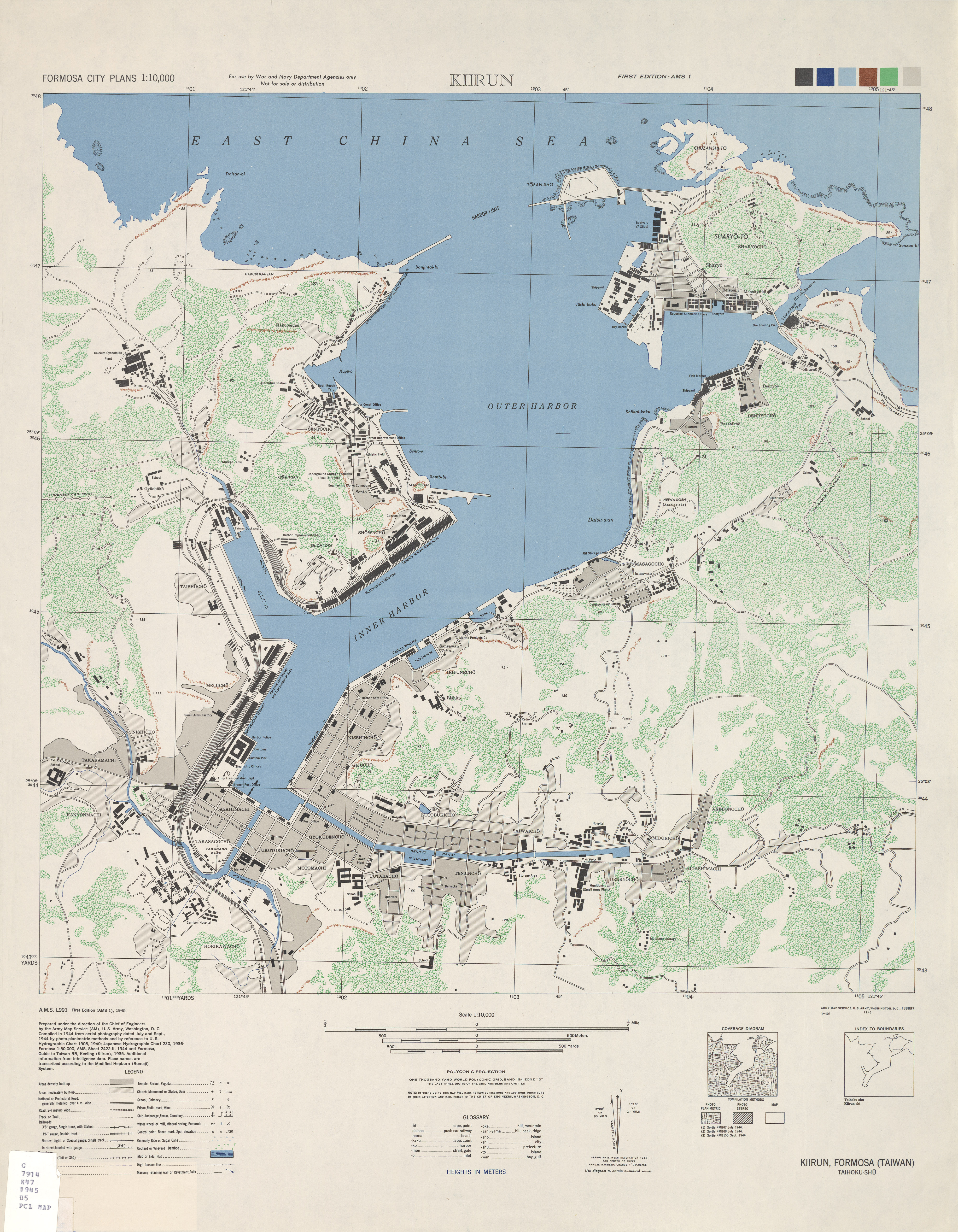
France's capture of the harbor in the autumn of 1884 drove the Qing defenders into the hills between Keelung and the Keelung River (see contemporary map here). Here they hastily built a second line of fortifications to frustrate any further French advance and provide forward bases from which to launch counterattacks. They also threw up trenches and protective works above the interior bank of the Keelung River to insure against a breach of the second line.

This network of fortifications left Keelung so well guarded that, when preparing to battle the armed resistance opposed to their takeover in 1895, Japanese military commanders chose to land their main force 30km to the south (at Gongliao [貢寮]) and approach the harbor from behind via a 2-day march over rugged mountain terrain. Even then, it took a fatal blunder by Chinese troops for the Japanese to storm Keelung's principal defenses without heavy casualties. Chinese records tell of a fierce battle fought in inclement weather along the slopes of Shiqiuling (獅球嶺) that caused heavy casualties on both sides. One version of events says that Cantonese soldiers guarding the battery mistook as Japanese the unfamiliar Chinese dialect spoken by an approaching Taiwanese relief force and opened fire. The Taiwanese, believing the Qing troops to have mutinied, fired back. The fighting decimated Shiqiuling's defenses. The Japanese took the fort the next morning and marched, almost unopposed, into Keelung.


Learning from experience, Japan reconfigured Keelung's defenses to handle potential threats from rival powers, including Russia, England, and (in the 1940s) the United States. Many of the Sino-French War era emplacements set next to Keelung Bay were abandoned and replaced by modern batteries set along strategic hilltops. New installations at Dawulun (大武崙), Baimiweng (白米甕), Shen Ao Keng (深澳坑), Gangziliao (槓子寮), and elsewhere afforded better defensive coverage and gave full play to the range and firepower of modern Western artillery.


- JM

2007-12-03

Spoils of a Distant Conflict - Taiwan and the First Sino-Japanese War (甲午戰爭)


It is unfortunate that so many of the "highlights" of Taiwan history seem centered on conflict – some big (like the 17th century ousting of the Dutch VOC and the Sino-French War) and some small (such as the myriad turf battles fought between different Chinese clans, between immigrant Chinese and indigenous Malayo-Polynesians, and between local malcontents and provincial authorities). This has led many in Taiwan to view the island's historical record as something best forgotten. However, recalling the decades (and occasional centuries) of relative peace between conflicts and the disparate influences (both positive and negative) that Taiwan's numerous occupiers and long-term residents have had on local culture and development leaves much room to recast the story of Taiwan to recognize its place on Greater China's eastern frontier while accepting and appreciating a cultural tapestry that includes more than a dozen important Malayo-Polynesian groups, Europeans, Japanese and Chinese from nearly every corner of China.


Physical separation from China – a two-day, dangerous journey by junk from Xiamen (廈門, Amoy, the main embarkation point for Taiwan on the Chinese Mainland) – ensured that Taiwan remained unknown to most Chinese and beyond any semblance of Chinese control until almost the 18th century. Taiwan's two centuries as part of China (1683 to 1895), were chaperoned, in the main, by unexceptional sub-provincial officials from Fujian who tried to profit as best they could from their assignment in the "sticks" while being either studiously avoided or taken advantage of by their subjects, ... who were also busy working to turn a profit from their adopted island.


The real threat of Taiwan being pared off by Japan, the U.S. or a European power helped finally turn Beijing's attention to island affairs in the 1870s. The military beefed up coastal defenses, installed and maintained strategic pathways (including Batongguan, 八通關越嶺道), and raised lighthouses to bolster China's claim to active sovereignty and give potential occupiers pause for thought before committing troops. Attention to the island spiked again after the Sino-French War (1883-85), when the island was granted provincial status (Taiwan had previously been governed as part of Fujian Province). The capital was moved from sunny Tainan to soggy Taipei and one of the Empire's first commercial rail lines was installed to link the deepwater port of Keelung to Taipei (Banka, 艋舺) and Hsinchu.


In the end, it was all a case of too little, too late. The island's status as a relatively recent acquisition, its physical separation from the Chinese Mainland, its proximity to Japan and the disintegration of central authority across much of China made Taiwan too tempting a prize in the aftermath of a war fought far to the north.

The First Sino-Japanese War (1894-1895)

In the closing years of the 19th century, Northeast Asia's crumbling status quo pushed Korea, ancient vassal and ally of China, to the center of regional rivalries. Japan wanted control of the strategically positioned peninsula and saw in either a collapse or rejuvenation of China the inevitable transformation of Korea into a forward base for unfriendly powers. On the one hand, China's collapse could very well consign the peninsula to Russia, Japan's main strategic rival in Northeast Asia. On the other, China's rejuvenation would surely reinforce the prejudices of Confucian Korea against Japan - a nation "slavishly" adopting alien Western values. Japan initiated hostilities to pull the kingdom, preemptively, into its political orbit.

Albeit brief and decisively one-sided, the First Sino-Japanese War (甲午戰爭) holds claim to several "firsts". It was the first modern conflict between Asian powers and the first time the latest in maritime weaponry – the ironclad battleship – had a central role in combat. It was also Japan's first test as an ascendant power in the Pacific.

The war represented a calamitous setback to China's efforts to limit to a handful of coastal districts foreign influence in her country. Ten years later, much of eastern China was open to trade and travel; Beijing had been sacked by an army of eight allied countries; and foreign powers had taken formal control of five new enclaves along China's seaboard as well as prime real estate in the northeast.

Positioned on the southern flank of the Ryukyu Islands (琉球, Loo-Choo Islands [see map here], which Japan had annexed less than two decades before), Taiwan was coveted by expansion-minded Japanese as both a protective buffer for the home islands and a projection of imperial ambitions in Asia. China, its imperial capital exposed and Northern Fleet at the bottom of the Yellow Sea, could offer little resistance to Japan's peace terms, which, among other demands, included the surrender of Taiwan and the Penghu (Pescadore) Islands. The Treaty of Shimonoseki was ratified on 8 May 1895, and China left Taiwan to its fate under Japanese occupation. The handover ceremony, originally scheduled to take place in Taipei, was actually convened in choppy waters off Bitoujiao (Punto San Diego) – Qing officials fearing reprisals from Taiwanese loyalists should the ceremony take place on land.

Largely unaware of the scale of their country's military defeat; sure of the difficulties Japan would have in occupying Taiwan; and hopeful that Japan's European rivals might step up to the island's defense, local Qing officials (to the apparent annoyance of the imperial court) and prominent Taiwanese made a hasty declaration of Taiwan independence -- 15 days after Treaty ratification and 6 days prior to the arrival of Japan's occupation force. Likely reflecting the sentiments of the island's ethnic Chinese majority, which had not previously contemplated separation from China, the president of the newly declared Republic of Formosa (台灣民主國), Tang Jingsong (唐景崧), professed the island's continuing loyalty to the Qing throne and subordinacy to China as a tributary state.

- JM

2007-11-16

Gold, Copper & the Kinkaseki Mine (金瓜石)

Seductive Treasure, Shameful Secrets
台灣金銅山 - 金瓜石


The (formerly) rich veins of gold and copper underlying Jiufen (九份) and Jinguashi (金瓜石, also spelled "Jinguashih") are part of the legacy of volcanic and subvolcanic activity that recast northern Taiwan's landscape between 1 and 2 million years ago. While lava spouted and volcanoes piled up across much of what is now Yangmingshan (陽明山, directly north of Taipei City), magma stopped just short of the surface here, leaving the region underlined with igneous rock and quartz-encrusted "breccia pipes".


Placer (alluvial) gold was discovered near the end of the 1880s in Keelung River (基隆河) sediment near Nuan Nuan (暖暖), at the eastern terminus of sampan routes traversing the Taipei Basin. One account attributes the discovery to a Cantonese member of a railway construction crew who had previously panned for gold in California and saw something enticingly familiar glinting in mud scooped from the river. The find sparked a gold rush that for several heady years saw the Keelung River bank done over in a motley hodgepodge of prospector tents and shanties.


While many came to work the riverbed, others prospected in the wilderness upstream, hoping to reach the font of Keelung's golden sands. Strikes were first made around the source of the Keelung River in the rugged hills around Jiufen, a settlement overlooking the sea once so remote and sparsely populated that its name (九份 - literally "Nine Portions") was conferred by merchants sailing the coast to designate the number of provision bundles they could expect to sell there. In 1893, less than two years before Japan took control of the island, a large strike was made beyond Jiufen, in the hills below Teapot Peak (茶壺山). Prospectors flooded in and, taking note of the unusual shape of a rocky outcropping, named the district Jin-gua-shih (金瓜石, "Pumpkin Rock").


By the 1890s, rights to mine beneath Jiufen had been licensed to several families, who divvied up and further subleased their holdings to the flood of hopeful prospectors. As a result, dozens (perhaps hundreds?) of small shafts were dug and worked in and around the town. Jiufen, like all mining towns, enjoyed its raucous boom days and, once the gold gave out, slid into melancholy bust.

The town was ready to crumble into obscurity when film director Hou Hsiao-hsien (侯孝賢) chose Jiufen's steep alleyways and fading façades as the backdrop for his 1989 film City of Sadness (悲情城市, see movie trailer here). Its place in Taiwan's history thus confirmed, Jiufen joined the pantheon of Taiwan's modern historical landmarks and is today a congested weekend tourist trap chock full of eateries, teahouses and souvenir shops.


The newer and richer mines at Jinguashi followed a somewhat different fate. After 1895, Japan consolidated and then nationalized mining operations at Kinkaseki (the Japanese pronunciation of Jinguashi). Mountains of earth were, literally, "moved" and the land was torn apart to reach and follow subterranean mineral veins. Copper was discovered in 1933 and, by the 1940s, Kinkaseki was producing more copper than any other mine in the Japanese Empire.

Nearly 600 British and Commonwealth soldiers taken prisoner during the 1942 fall of Malaysia and Singapore were shipped to Kinkaseki and interned at the most infamous of Japan's 15 POW camps on Taiwan. The more than 1,100 prisoners held at the Kinkaseki camp between 1942 and 1945 worked as slave labor in the mines and endured the harshest of conditions. Cave-ins, injury, disease, malnutrition and executions made Kinkaseki one of the worst of Japan's POW camps. Fewer than 100 of the Allied prisoners held at Kinkaseki are believed to have survived to war's end.

With the end of the Second World War, Jinguashi mines reopened under ROC government management. However, increasing tunnel depths and engineering difficulties gradually made the mine uneconomical ... and operations shut down for good in 1971.


- JM

2007-11-09

Slice o' South China Sea Heaven II (東沙群島)


Dongsha lies at the northern end of the South China Sea, some 160km southeast of Hong Kong and 240km southwest of Taiwan. The halo-shaped atoll is a living coral metropolis that preserves the outline of a long-submerged ancient volcano. With the exception of sandy Dongsha Island/Islet (a 2+ square kilometer patch of dry land), the entire atoll lies just below South China Sea waves. Surrounded by open ocean for at least a hundred miles in all directions, Dongsha's coral spires have given nightmares to navigators for centuries. Early European maps of the South China Sea marked the Pratas with a simple circle of crosses to call attention to what happens to big ships that wander too close. Today, the abandoned hulks of several ships still cling to the shallow crest of the atoll.

Because atoll shallows are navigable to low-draft fishing boats, fishermen from China, attracted by the area's rich marine life, arrived to build temporary and then semi-permanent lean-tos on Dongsha Island. However, with no fresh water (except for rain) and little to eat, Dongsha has never presented conditions suited to long-term human settlement.

Although nominally part of China, a Japanese entrepreneur landed on the deserted atoll around 1907 to mine guano - stratified bird droppings rich in phosphate and nitrogen (think fertilizer and gunpowder). China didn't make much of a fuss about the intrusion
(the Qing Dynasty was busy collapsing at the time), but negotiated a Japanese withdrawal in 1909. Dongsha Island returned to hosting itinerant fishermen until World War Two, when Japan stationed troops and built an airfield for Zero fighters.

After 1949, Dongsha was put under the control of the ROC Marines (陸戰隊), which promptly installed heavy artillery, barbed wire, concrete bunkers and everything else necessary to rebuff the PLA offensive bound to come. In the years of calm that ensued, however, thousands of Marines, bored stiff in a primitive paradise, improvised new and creative ways to expend the generous rounds of artillery and rifle shells supplied by headquarters. Dongsha's coral reef and marine ecology suffered greatly under more than four decades of military care.


Today, Dongsha is administered by Taiwan's Coast Guard (海巡署), which oversaw an overdue about-face change in policy toward the atoll. Those now stationed on the island by and large observe a ban on all resource harvesting (fishing, crabbing, souvenir hunting, etc.) and sup only on food and drink shipped in from Kaohsiung. I learned that even swimming is against the rules for those stationed there (at least strongly frowned upon). A main objective of the Coast Guard on this southern outpost of the ROC, beyond upholding Taiwan sovereignty in the area, is protecting the coral reefs from further destruction. This is pursued primarily by shooing away the fishing boats (mostly from China and Vietnam) that move in unfailingly after nightfall in hopes of working Dongsha reefs. The Coast Guard has a difficult, often thankless task that is made exponentially more difficult by Taiwan's extemporized international standing.


Rather than impounding trespassing vessels (which might upset the cordial status quo that accepts Taiwan as custodian of Chinese sovereignty on the Pratas), Taiwan's Coast Guard seems bound to a good neighbor policy in all dealings with fishermen and their boats - even when "caught in the act". While on Dongsha Island, we watched the Coast Guard return to sea a small boat of shellfish divers from Hainan Island (海南島, China) whose engine had conked off the reef. The Coast Guard repaired the engine and escorted the divers and their boat into open waters beyond the reef, where they surely rendezvous'd with a mother ship anchored just outside Taiwan's territorial waters.


Dongsha Island and its reef appear, finally, to have a chance to recover. White coral sand beaches are now clear (pretty much) of razor wire and the more obvious defensive fortifications have been cleared away or allowed to crumble. Illicit reef destruction by fishermen and rising / warming waters now pose the greatest threats. One of the Hainan shellfish divers related that nearby waters are much warmer than in years past and large swathes of coral have turned black. Shellfish catches apparently aren't what they used to be either.


I remain in awe of Dongsha's tropical beauty and isolated tranquility. We had free reign of the island while there, and I took full advantage of the week in paradise - walking the beaches, sitting patiently by sand crab hovels awaiting an appearance, taking pictures and enjoying sunsets. The Pratas seems in good hands with the Taiwan Coast Guard, which seems as eager as anybody to make sure the atoll has time and space to recover.


I hope that the National Park, when declared, continues to focus on conservation, with just enough tourism allowed to win for the reef broader appreciation and respect as a natural heritage site worthy of greater regional and international protection. The international community should also take advantage of Taiwan's willingness to protect and preserve Dongsha's isolation to the benefit of the entire Southeast Asia ecosystem.

Special thanks to those on the Pratas who helped turn a week-long stay into memories sure to last a lifetime.


-JM