Showing posts with label 東北. Show all posts

2009-05-04

New NE Coast Walkway / Bike Path Opens (新開的外木山到翡翠灣的自行車步道)


After a sabbatical of nearly a year, I'm back with more articles and thoughts on life along Taiwan's Northeast Coast and travels around the beautiful island of Taiwan.


I took the afternoon this past Sunday to collect thoughts; ponder the meaning of life, the universe and Everything and get some exercise during a spell of balmy spring weather. I frequently cycle the Keelung (基隆市) to Feicui (Jade or Green) Bay [翡翠灣] route, and my mettle has been oft tested ... and cycling direction occasionally diverted ... by cognizance of the challenges presented by the formidable hills straddling the Keelung City / Taipei County border - just ahead of the fishing town of Wanli (萬里鎮).


This time, cycling through Dawulun (大武崙) and then huffing up Provincial Route 2, which follows a coastal ridge overlooking Dawulun Fishing Port (大武崙漁港) & Waimushan Beach (外木山海水浴場), I was pleasantly surprised to find myself paralleling a new wood planked walkway installed to connect Dawulun Fishing Port (the walkway actually starts from the nearby pink [and now defunct] outdoor swimming complex-cum-seafood restaurant) to Wanli's fishing harbor, next to the wide sand beach along Feicui Bay. The walkway skirts the coast, avoiding hills and attendant steep grades. Very pleasant - with panoramic views of the rocky shoreline and Keelung Islet in the distance.


While this new walkway and bike path extends just 2.5km, when packaged together with the readily biked coastal roadways further westward and the 2-year old bike path that connects Waimushan Beach almost into Keelung City's busy downtown, cyclers can now navigate relatively easily a pleasantly undulating coastal route from downtown Keelung out as far as Yeliu (野柳), Jinshan (金山) and beyond.


This section of the coast is simply gorgeous, passing several sand beaches and majestic sandstone formations (including the 'Frozen Beach' outcropping just before Yeliu), as well as several 'human interest' points including pre-fab 'UFO' vacation bungalows (great pics here) just east of the Howard Plaza Green Bay Resort; northern Taiwan's main jump-point for hang gliding; trails leading up to the Japanese-era Dawulun Fort (大武崙砲臺) and several shallow, easy-to-access snorkeling / diving areas.

Departing from Keelung City, a cycling trip to Jinshan can be done in under 1.5 hours (one-way) taking advantage of the new coastal walkway. Plan on much more time, however, to enjoy all the out-of-the-way attractions this 25km stretch of coastline has to offer. If planning to walk, I recommend driving Route 2 to Waimushan Beach (map location here), where there is usually adequate parking space, and exploring the area from there.

Just a note ... To check out the deteriorating (albeit quite photogenically) Reagan-era fiberglass-reinforced 'UFO' vacation bungalows without paying for Howard Plaza Resort admission - cycle or walk through the narrow alley immediately to the left of the 7-11 on Route 2. The alley takes a few short jogs before opening onto the bungalow district and adjacent sand beach.


A Google Map rough-and-dirty guide to the approximate route from Keelung City out to Jinshan can be viewed by opening the link here.

- JM

2008-03-11

Historic Forts and Batteries (基隆古砲台)

Its natural deep sea anchorage and proximity to Taipei made Keelung of vital strategic importance to Taiwan's rulers for nearly two centuries. Today, while a few hilltop military posts remain manned (with at least one topped by a prominent battery of antiaircraft missiles), most former strongholds have been abandoned to weekend hikers, gardeners, fast growing vegetation ... or some combination of all three.

Beyond the half dozen or so batteries designated as historic sites by the city, Keelung has at least as many which, a la Raiders of the Lost Ark, now lie buried beneath banyan trees and decades of growth. In addition to the formal batteries, dozens of lookouts and pillboxes are also scattered in several rings around the city - reminders that the entire Keelung area was designated a military zone「要塞」 by the Japanese during their 50-year rule on the island (1895-1945).

However, as with a good deal of Taiwan history, much in the way of details on northeast coast fortifications has been lost or buried away in dank files accessed only occasionally by the particularly diligent graduate student, ... leaving the visitor to make educated guesses about when structures were built and where they fit into island defense.

Today, these relics of the past are a definite enticement to visiting the Northeast Coast. Off the beaten path, even well-marked batteries rarely see more than a trickle of visitors. In a crowded place like Taiwan, their combination of solitude, great views (locations were chosen specifically for spying across the surrounding terrain) and enigmatic stone block structures are greatly appreciated!

Keelung Fortifications

After the Dutch abandoned Keelung for a second and final time in 1668, San Salvador - the earliest fort on Keelung Bay - sat crumbling and largely forgotten. China's supremacy in East Asia was still widely respected and its harbors were secure even without protective fortifications.


Expansion-minded Western traders undermined and ultimately demolished the Chinese peace, setting themselves up at prime anchorages around the region, playing local politics, and eventually delivering up entire slices of Asia to direct European rule (e.g., the Dutch in Batavia [1619], the British in Singapore [1819]; the Russians in Vladivostok [1860]; and the French in Saigon [1862]).


In response to this unprecedented threat from the sea, the Qing built two forts astride Keelung's inner harbor entrance. These quickly proved their worth by foiling at least three attempts by the British to shell the town during the First Opium War (1839-42).

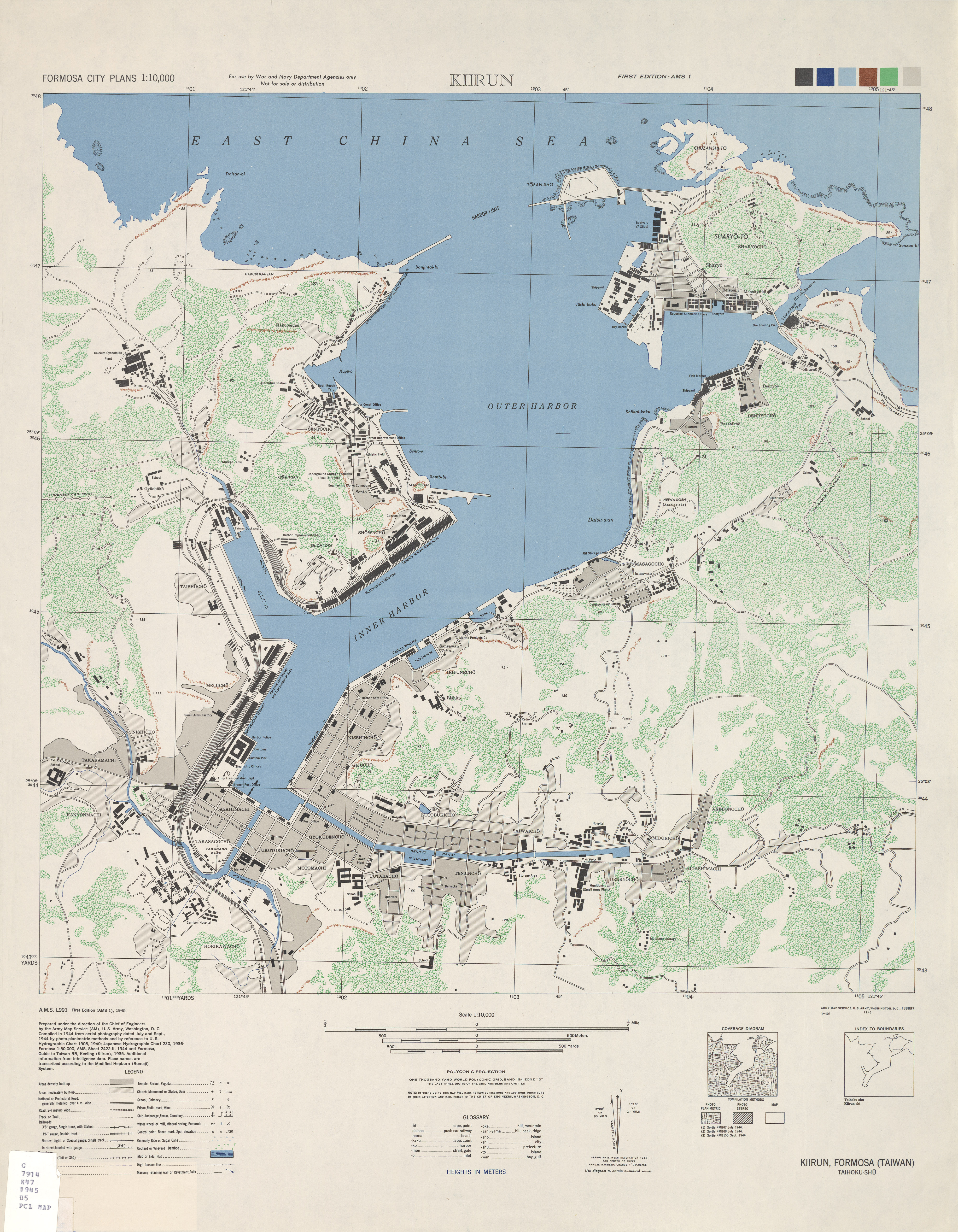
The Qing later extended Keelung's fortifications and, by the early 1880s, some 10 artillery batteries fringed the bay. Most were set close to the water's edge to compensate for limited cannon range and, as a result, have since disappeared beneath container terminals and urban planning.

France's capture of the harbor in the autumn of 1884 drove the Qing defenders into the hills between Keelung and the Keelung River (see contemporary map here). Here they hastily built a second line of fortifications to frustrate any further French advance and provide forward bases from which to launch counterattacks. They also threw up trenches and protective works above the interior bank of the Keelung River to insure against a breach of the second line.

This network of fortifications left Keelung so well guarded that, when preparing to battle the armed resistance opposed to their takeover in 1895, Japanese military commanders chose to land their main force 30km to the south (at Gongliao [貢寮]) and approach the harbor from behind via a 2-day march over rugged mountain terrain. Even then, it took a fatal blunder by Chinese troops for the Japanese to storm Keelung's principal defenses without heavy casualties. Chinese records tell of a fierce battle fought in inclement weather along the slopes of Shiqiuling (獅球嶺) that caused heavy casualties on both sides. One version of events says that Cantonese soldiers guarding the battery mistook as Japanese the unfamiliar Chinese dialect spoken by an approaching Taiwanese relief force and opened fire. The Taiwanese, believing the Qing troops to have mutinied, fired back. The fighting decimated Shiqiuling's defenses. The Japanese took the fort the next morning and marched, almost unopposed, into Keelung.


Learning from experience, Japan reconfigured Keelung's defenses to handle potential threats from rival powers, including Russia, England, and (in the 1940s) the United States. Many of the Sino-French War era emplacements set next to Keelung Bay were abandoned and replaced by modern batteries set along strategic hilltops. New installations at Dawulun (大武崙), Baimiweng (白米甕), Shen Ao Keng (深澳坑), Gangziliao (槓子寮), and elsewhere afforded better defensive coverage and gave full play to the range and firepower of modern Western artillery.


- JM

2008-02-12

Cycling Taiwan (台灣腳踏車遊)


Growing up in the Michigan countryside, I learned early the freedoms afforded by a bicycle. I explored fairly fully the dirt roads in and around Metamora and occasionally struck out for longer hauls to Oxford. I thought it a pretty impressive accomplishment when I finished my first round trip to Lapeer - some 25 miles away. My gold ten-speed offered mobility, exercise and a way to get to and from summertime lawn mowing jobs.


Once at university, however, shorter distances and the prospect of worrying over the safety and health of a bike chained to a grill outside East Quad relegated cycling to an occasional activity done more to renew the feel of high school than to commute around Ann Arbor (although I did make it out to Ypsilanti once). When during our senior year one of my best friends shared her plans to spend the upcoming summer on a month-long cross-country bike caravan (Seattle to Michigan), I could only wonder at the challenges ahead.

A move to Taiwan in the early 1990s made prospects of cycling even more remote. While Taipei, mercifully, is now ringed with bicycle paths and cyclists have increasingly taken to braving city streets (where motorists have grudgingly begun to accept their right-of-way), all this came, regrettably, after my time. Our move to Keel
ung was prompted, in fair part, by the prospect of more space, green views and roads to bike.

As before, I took to exploring the immediate vicinity and first saw much of Keelung and the Northeast Coast's green interior from a bicycle seat. While the region has some of the island's most rugged coastal terrain, roads tend to follow valleys as much as possible, making for treks that rarely exceed a "moderate" level of difficulty (of course, there are also plenty of hills to navigate if one so desires).

If I have set an example for others by pedaling out on the weekends, many have since outdone me. A few of our friends now often commute by bike from their homes near Keelung to jobs in Taipei (about an hour+, over heavily trafficked roads) and several families in our church meet nearly "religiously" on Saturday mornings to cycle over increasingly challenging courses in Keelung and Taipei County. What's more, with our children now increasingly able and willing to participate, cycling is being embraced as not only a family activity, but as a way to face and beat new challenges, develop a rapport with the outdoors and give (and receive) support as part of a team.


Over the past two months, my daughter and I have had the pleasure to join in two challenging cycling activities. The first, described briefly in a previous post, was organized by the Chinese Christian Relief Association (中華基督救助協會) as an event to draw attention and donations to the CCRA's ongoing work with disadvantaged families and after-school tutoring for children with special needs. Nineteen teams of two set out early on December 14th from the Eluanbi (Erluanbi, 鵝鸞鼻) Lighthouse at Taiwan's southernmost point – hopeful that they would achieve Taiwan's northernmost point at Fuguijiao (富貴角), 700 km away and 9 days later. The challenge of the trip was enhanced by our riding tandem (2-person) bicycles and the participation of primarily non-seasoned cyclists (including us). Nearly half the teams had pre-teens on the second seat. Quite a few in the group were over 60. The youngest was five.

The route was planned so as to pass through major towns, where brief PR events, often attended by local officials, helped publicize the CCRA cause. We stuck largely to main county roads, which took us through Taiwan's industrial heartland. Actually, getting away from industry along the western coast is difficult without either navigating the awkward web of roadways that skirt the Taiwan Strait or heading into the Central Mountain foothills. Both present challenges best left for another cycling trip.


The weather cooperated to a surprising degree, with sunshine following us nearly all the way to Taoyuan County. Tara's initial nonchalance about the challenges ahead (she'd heard that kids could ride in the chase car [小蜜蜂] if their legs gave out) turned into impressive determination. She biked behind me the entire 700 km, growing in self-confidence and experience.


We reached Fuguijiao on the North Coast late on December 22nd after a day under overcast, occasionally drizzly skies. Tara proudly remarked that she wouldn't mind continuing on down the East Coast – mostly because she wanted to continue traveling with this tremendous group


and partly because she felt that more biking beat, hands down, the prospect of returning to school in another two days. Thirty-eight individuals had come together as strangers and were to part as friends. The support team fielded by CCRA handled the difficult logistics necessary over the entire trip, which included escorts from county police, event organization, overnight arrangements, rest stop and lunch arrangements and the handling of myriad details of which we could only appreciate the results. Their dedication, given to help ensure the CCRA can continue in its main mission, testifies most strongly to the value of CCRA work in Taiwan.


Soon after returning home, we were invited by the abovementioned group of weekend bikers to join in a planned cycling trip in February from Keelung to Taitung (Taidong, 台東), down the East Coast. We agreed, but with consternation over the weather – which had (and has) been atrocious (rainy and cold) for the past month across northern and eastern Taiwan. As our departure on February 1st drew near, the weather simply got worse.


It had not improved by the time we gathered in Guogang (過港 / 暖暖) outside of Keelung on Friday morning. Two families, including ours, opted for the warmth of the chase cars, in which we followed those (three families, including 5 kids!) who had elected to brave it out. We met up in Fulong (福隆) for lunch, after which the bikers followed the coast southward to finish up the 95 km scheduled for Day One at Wujie (五結鄉), south of I-Lan City, and we surrendered to an afternoon at the hot springs in Jiaosi (礁溪).


The rains petered out, and everyone, including Tara and I, made the remainder of the 5-day journey by bike (although we all opted out [per plan] of biking the 100km-long Suhua Highway (蘇花公路) – known for its dramatic scenery, sharp curves and careening gravel trucks).


The East Coast from Hualien City down through Taitung is a wonderful ride. We took the relatively level Rift Valley (mostly down County Route 193 [193縣道]), passing mile after mile of newly planted rice paddies before heading into the Coastal Mountains south of Yuli (玉里鎮). After a steady, but manageable, uphill climb of 5 or so kilometers, we passed through a newly completed 2km tunnel on Yuchang Road (玉長公路) that opened onto Taitung County and marked the start of a brisk downhill ride to the Pacific shoreline. We ended our journey at Sansiantai (Sanxiantai, 三仙台) north of Taitung City, piled the bikes into our two vans and headed northward the next morning toward home.

Unsurprisingly, in light of eastern Taiwan's unpredictable winter weather, the day we drove back was the first to see sunny blue skies. We stopped off at several places, including the coastal scenic area at Shihtiping (石梯坪) and a special bed & breakfast place (Houhu, 後湖水月) that serves up great views of the coast and wonderful morning coffee – thanks Wendell (!).


Tara and I look forward to continued biking adventures. Our two experiences this winter have taught us that distance biking around the island is both doable and fun. Passersby were always ready with a thumbs-up and a smile. We saw many other biking groups on the road as well - most traveling without a support vehicle and their gear and travel essentials strapped across the back tire and under the seat. No matter where you find yourself in Taiwan, chances are you aren't excessively far from civilization – particularly if your definition of such covers 7-11s, ... which truly are everywhere.


- JM

2007-11-16

Gold, Copper & the Kinkaseki Mine (金瓜石)

Seductive Treasure, Shameful Secrets
台灣金銅山 - 金瓜石


The (formerly) rich veins of gold and copper underlying Jiufen (九份) and Jinguashi (金瓜石, also spelled "Jinguashih") are part of the legacy of volcanic and subvolcanic activity that recast northern Taiwan's landscape between 1 and 2 million years ago. While lava spouted and volcanoes piled up across much of what is now Yangmingshan (陽明山, directly north of Taipei City), magma stopped just short of the surface here, leaving the region underlined with igneous rock and quartz-encrusted "breccia pipes".


Placer (alluvial) gold was discovered near the end of the 1880s in Keelung River (基隆河) sediment near Nuan Nuan (暖暖), at the eastern terminus of sampan routes traversing the Taipei Basin. One account attributes the discovery to a Cantonese member of a railway construction crew who had previously panned for gold in California and saw something enticingly familiar glinting in mud scooped from the river. The find sparked a gold rush that for several heady years saw the Keelung River bank done over in a motley hodgepodge of prospector tents and shanties.


While many came to work the riverbed, others prospected in the wilderness upstream, hoping to reach the font of Keelung's golden sands. Strikes were first made around the source of the Keelung River in the rugged hills around Jiufen, a settlement overlooking the sea once so remote and sparsely populated that its name (九份 - literally "Nine Portions") was conferred by merchants sailing the coast to designate the number of provision bundles they could expect to sell there. In 1893, less than two years before Japan took control of the island, a large strike was made beyond Jiufen, in the hills below Teapot Peak (茶壺山). Prospectors flooded in and, taking note of the unusual shape of a rocky outcropping, named the district Jin-gua-shih (金瓜石, "Pumpkin Rock").


By the 1890s, rights to mine beneath Jiufen had been licensed to several families, who divvied up and further subleased their holdings to the flood of hopeful prospectors. As a result, dozens (perhaps hundreds?) of small shafts were dug and worked in and around the town. Jiufen, like all mining towns, enjoyed its raucous boom days and, once the gold gave out, slid into melancholy bust.

The town was ready to crumble into obscurity when film director Hou Hsiao-hsien (侯孝賢) chose Jiufen's steep alleyways and fading façades as the backdrop for his 1989 film City of Sadness (悲情城市, see movie trailer here). Its place in Taiwan's history thus confirmed, Jiufen joined the pantheon of Taiwan's modern historical landmarks and is today a congested weekend tourist trap chock full of eateries, teahouses and souvenir shops.


The newer and richer mines at Jinguashi followed a somewhat different fate. After 1895, Japan consolidated and then nationalized mining operations at Kinkaseki (the Japanese pronunciation of Jinguashi). Mountains of earth were, literally, "moved" and the land was torn apart to reach and follow subterranean mineral veins. Copper was discovered in 1933 and, by the 1940s, Kinkaseki was producing more copper than any other mine in the Japanese Empire.

Nearly 600 British and Commonwealth soldiers taken prisoner during the 1942 fall of Malaysia and Singapore were shipped to Kinkaseki and interned at the most infamous of Japan's 15 POW camps on Taiwan. The more than 1,100 prisoners held at the Kinkaseki camp between 1942 and 1945 worked as slave labor in the mines and endured the harshest of conditions. Cave-ins, injury, disease, malnutrition and executions made Kinkaseki one of the worst of Japan's POW camps. Fewer than 100 of the Allied prisoners held at Kinkaseki are believed to have survived to war's end.

With the end of the Second World War, Jinguashi mines reopened under ROC government management. However, increasing tunnel depths and engineering difficulties gradually made the mine uneconomical ... and operations shut down for good in 1971.


- JM

2007-11-01

Hill Indigo (大菁)


Indigo, one of civilization's oldest dyes, has tinted the robes of Egyptian pharaohs and brightened the clothing of both Chinese peasant and American farmhand (think Levis jeans). Before cotton was "King", indigo was one of the U.S. Deep South's most important cash crops.


(click to open larger image)


Rather than describing a particular species, indigo refers to a widely dispersed group of plants that contains the compound indican. Hill indigo (Strobilanthes cusia) one of two major commercial indigo plants cultivated in Taiwan was reportedly introduced in the late 1700s from the Chinese mainland, where it is native. For more than a century afterward, indigo blue defined the color of the Taiwanese wardrobe.

Synthetic indigo, formulated in the 1890s by German chemists, signaled the beginning of the end for Taiwan's indigo industry. By the 1920s, local textile mills had switched completely over to synthetic dye stocks.


Recognition: Naturalized hill indigo today grows in northern Taiwan along mountain streams well-shaded by forest canopy. Patches can be found throughout Keelung, eastern and northern Taipei County, and Yangmingshan National Park (and probably other parts of Taiwan too). As hill indigo is not indigenous to the island, significant tracts typically signal areas of previous commercial cultivation. Look for signs of terracing and pits where the dye would have been bleached from leaves.

The herbaceous plant grows to over one meter in height and produces delicate lavender-white flowers during winter (December/January). Its fleshy leaves are serrated and grow to about 11cm in length. Leaves emerge in opposing pairs from the main stem, with leaf pairs alternating at right angles to one another (in a repeating "cross" formation) up the stem.


-JM